Molyneux
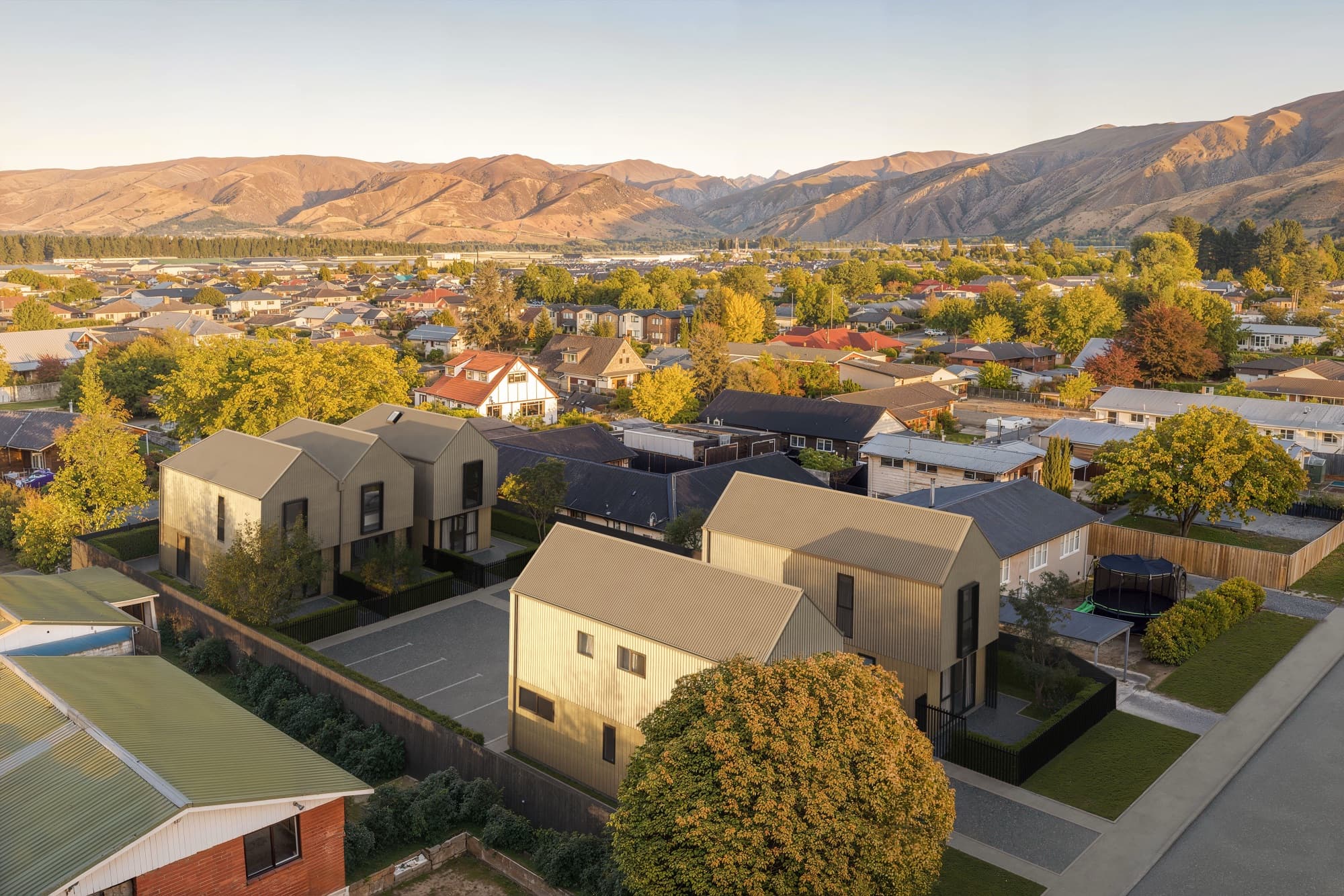
RAM Projects' development in Cromwell. The two aerials are photomontages: the finished homes composited into real drone photography of the site.
Renders by project type
Aerial renders show an unbuilt development from drone height, so buyers can see how the homes sit on the site, next to the neighbours and against the landscape. There are two kinds: an aerial rendered entirely in 3D, and a photomontage that composites the homes into real drone photography of the site. Render Works produces both.
A development needs an aerial render when the setting or the layout is part of what buyers are paying for, and a street-level view cannot show it. These are the situations where Render Works has used aerials:
A 3D aerial renders the whole view, while a drone photomontage places rendered homes into a real photograph of the site. Both show the development from above. They differ in what surrounds the homes and how much freedom you have with the camera.
| 3D aerial render | Drone photomontage | |
|---|---|---|
| Starting point | The 3D model and the scene built around it | Real drone photographs taken over the site |
| Surroundings | As detailed as the scene is built | The actual neighbours, roads and hills |
| Camera | Can be placed anywhere, including heights a drone cannot fly | Fixed to where the drone photographs were taken |
| What you supply | Plans, site plan and landscape drawings | Plans, plus drone photographs supplied early |
| Best for | Masterplans and sites with nothing built around them yet | Showing the homes in the exact setting buyers will see |
The two Molyneux aerials are photomontages. The finished homes were composited into drone photographs of the Cromwell site, so a buyer sees the real Cromwell basin, the real neighbouring properties and the real hills behind. The Molyneux case study explains how the renders were matched to the photography.
Buyers use an aerial render to understand where a home is before they look at what it is like inside. That is why aerials usually lead a campaign. On Rocks on Holloway the aerials establish the place, the exteriors show form and materials, and the interiors show how the homes feel to live in.
Record high
Otago consented a record number of new homes in the year ended June 2026, and Queenstown-Lakes district passed 2,000 new homes consented for the first time on record, more than two-thirds of the region's total.
Four of the aerial projects on this page are in Otago, where buyers are choosing between many new developments and the lake, river or hills around each one are a large part of the appeal. On a project website, the aerial is often the masterplan view: the Kōroto site uses its aerial renders that way. In a video, the aerial is the opening that carries the buyer from the setting into the homes. Read more in our guide to the property development marketing toolkit and on the cinematic walkthrough video service.
An aerial render needs more site information than a street view. Supply these where you have them:
For Molyneux, the drone photography was supplied early in the project, which let the camera angles, light and composition of the renders be matched to it. The guide to what to provide for a 3D render project covers the drawings in more detail.
An aerial render is accurate when the homes sit in their true positions, at the right scale, inside surroundings that match the real site. Buyers use aerials to judge outlook and neighbours, so a flattering but wrong context misleads them.
The same care helps outside marketing. Aerial and streetscape views can explain siting and bulk in a consent application, which we cover in the guide to 3D renders for resource consent in NZ. Aerials are part of our 3D architectural render service.
Each project below includes at least one aerial view. The links go to the project page and to the case study.
RAM Projects' development in Cromwell. The two aerials are photomontages: the finished homes composited into real drone photography of the site.
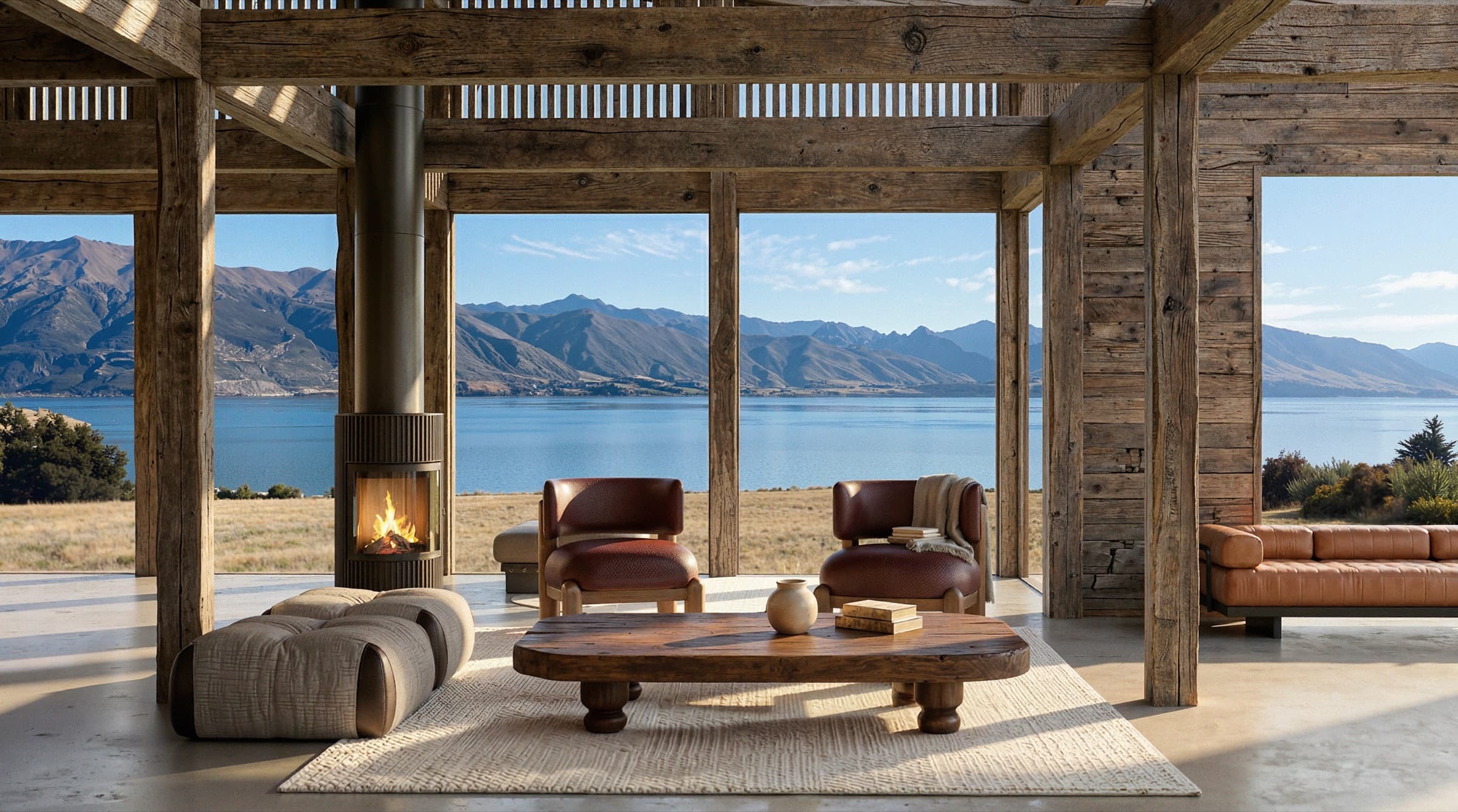
A lakeside development at Lake Hāwea. Aerial masterplan renders place each home with its outlook to the water, plus the boat house and clubhouse.
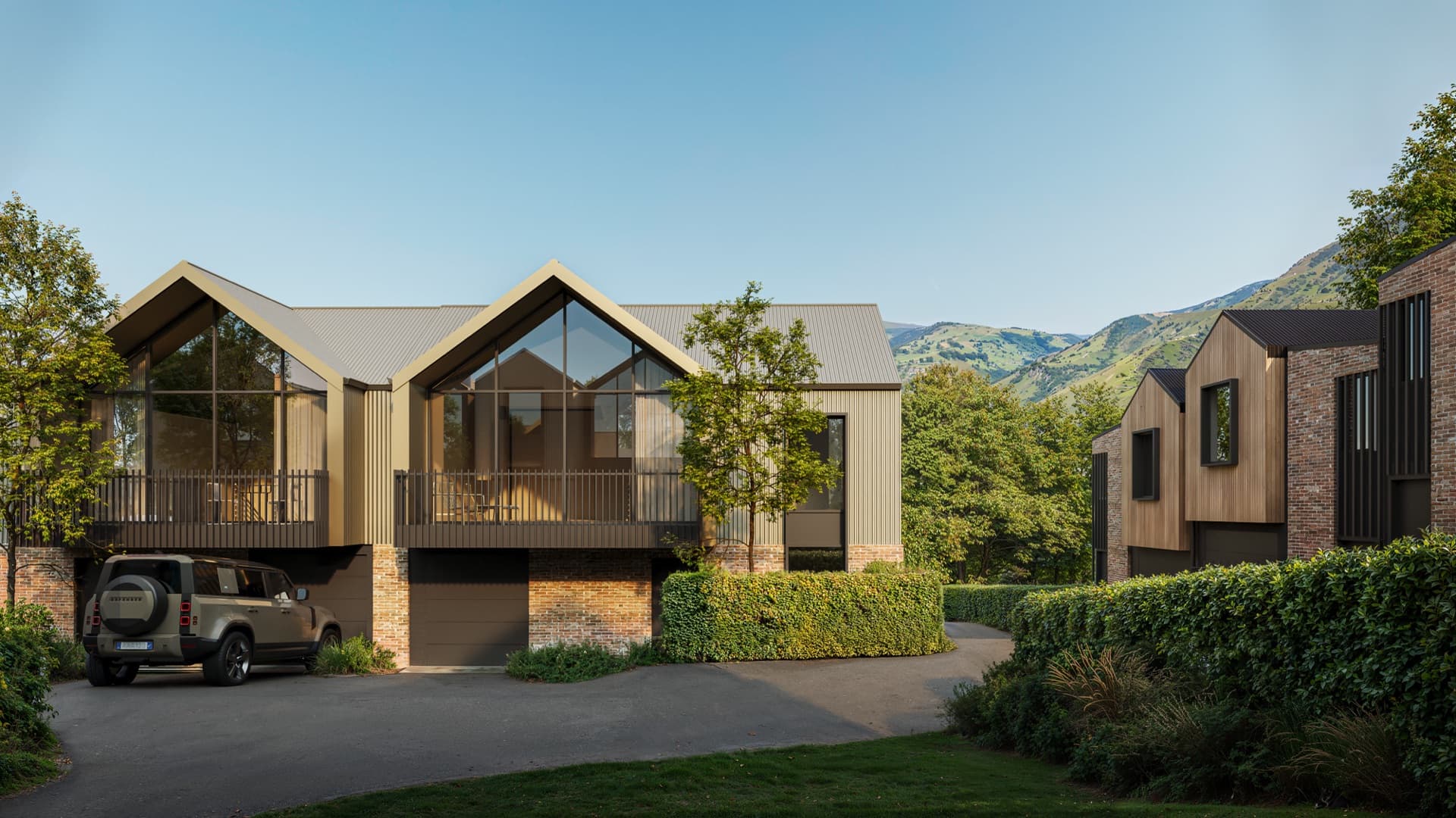
RAM Projects' Cromwell development. Two aerial shots put the homes against the Kawarau River and the hills behind the town.
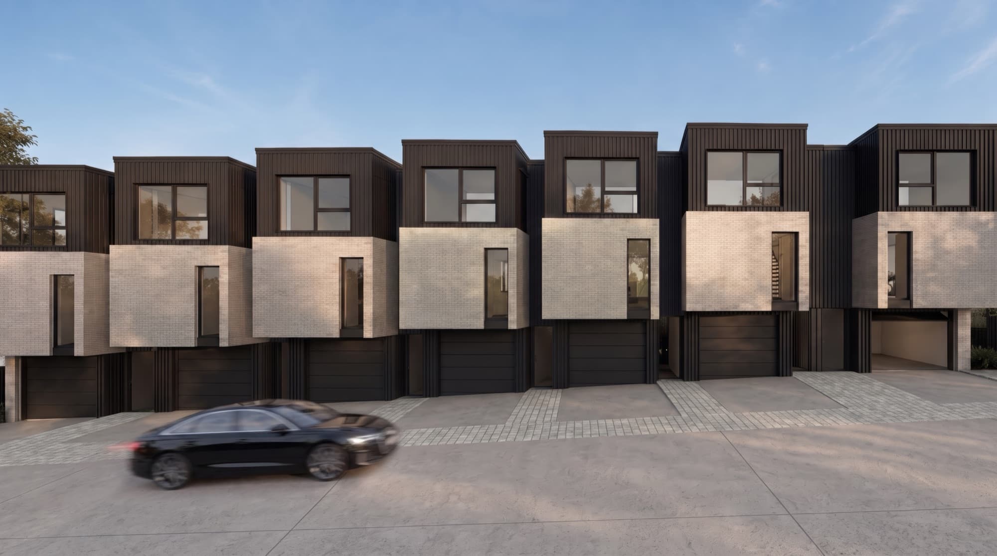
An eight-home townhouse site in Tōtara Vale, Auckland. A drone-height aerial places the terrace among the surrounding streets and houses.
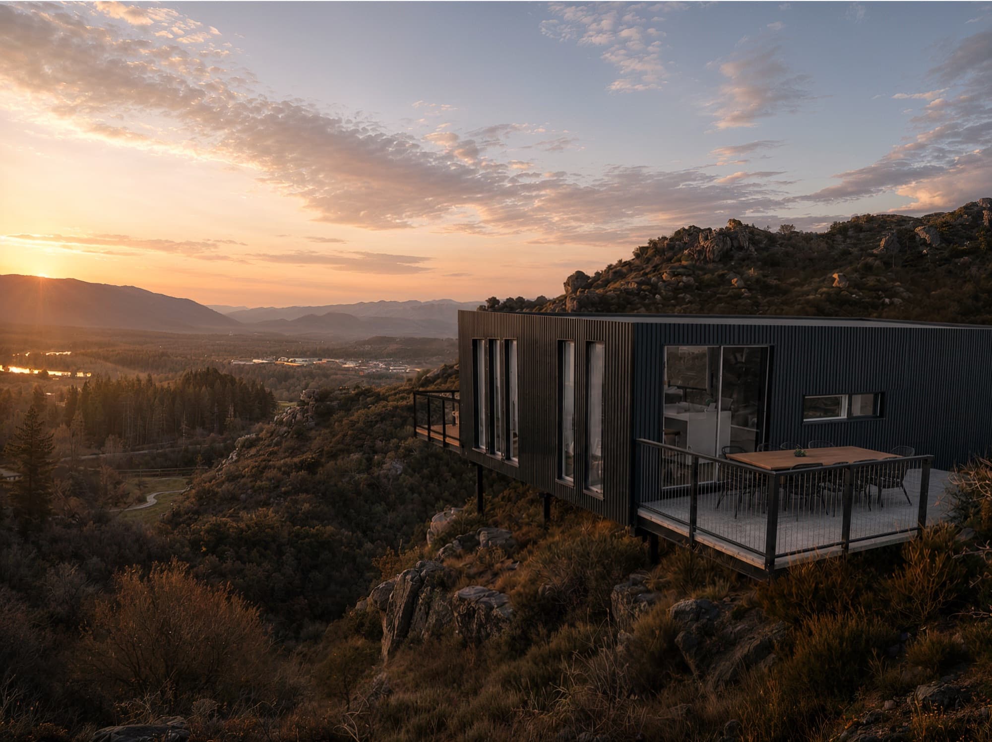
A single home on a steep, rocky section above Alexandra. A dusk aerial shows the house set into the rock outcrop, with pines on the ridge.
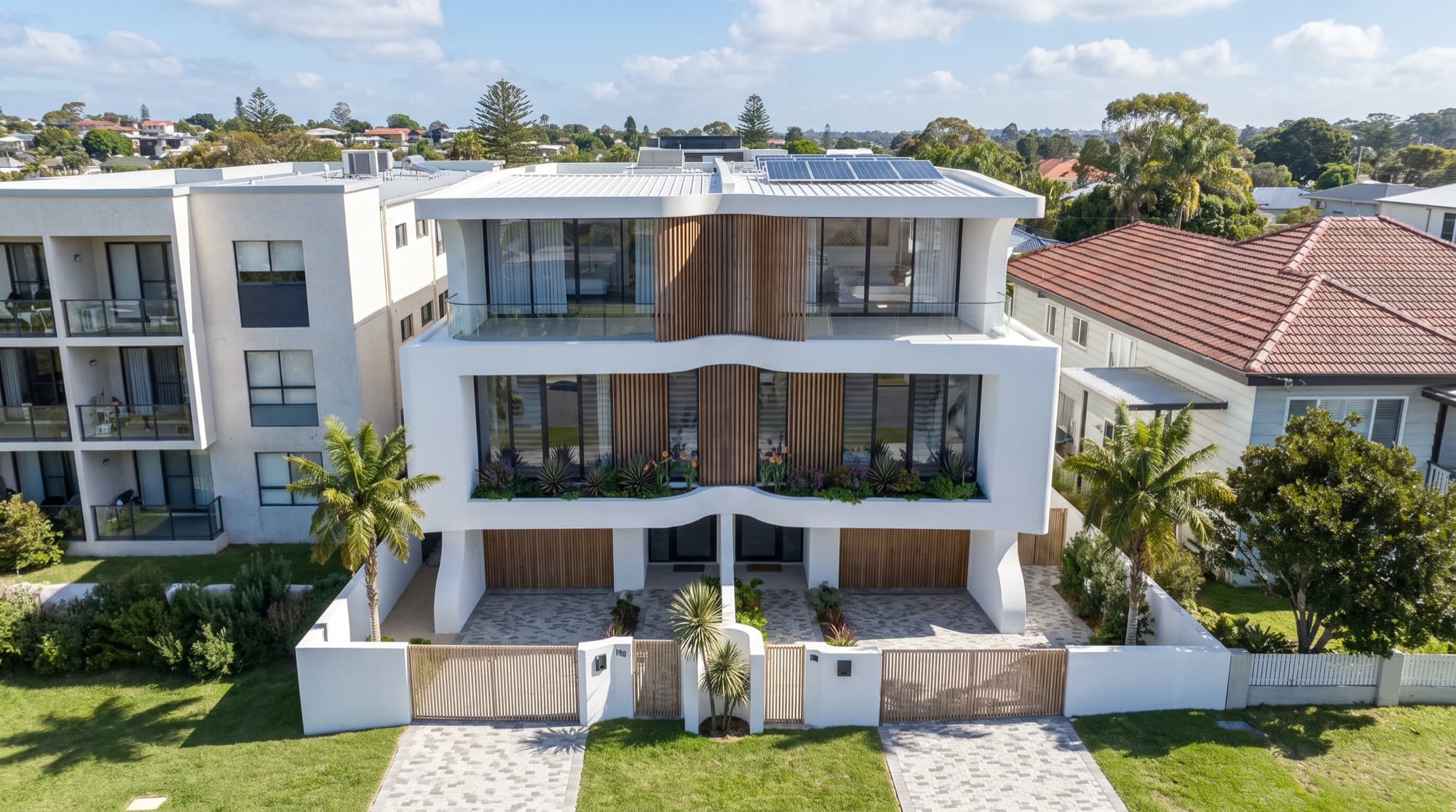
A coastal development in Redhead, NSW. The aerial composites the finished homes among the real Redhead rooftops.
A drone photomontage combines a photorealistic render of the unbuilt homes with a real drone photograph of the site. For Molyneux in Cromwell, drone photography of the site was supplied early and the finished homes were composited into it, with camera angle, light and composition matched, so buyers see the development in its actual surroundings.
Only for a photomontage, where the photographs have to be taken over the real site. A fully 3D aerial is built from the plans and the scene around them, so it does not need a drone flight. If you want a photomontage, supply the drone photographs early so the render cameras can be matched to them.
Yes. The Lanes Road home above Alexandra sits on a steep, rocky 6,244 m² section, and the owner's brief asked for an aerial. The dusk aerial shows how the house is anchored into the rock outcrop, which a street-level view could not show.
Yes, especially on a long or deep site. The Ludlow Terrace set in Tōtara Vale includes a drone-height aerial that places all eight homes among the neighbouring streets and houses, alongside four exteriors and five interiors.
Yes. The Kōroto walkthrough moves from the wider lake setting down into the homes using the same look as the stills, and the Molyneux video moves through the renders and the development's Cromwell setting. Starting a film from the air gives buyers the layout before they see the rooms.

Send us your site plan and any drone photography you have, and we will tell you whether a 3D aerial or a photomontage suits the site.