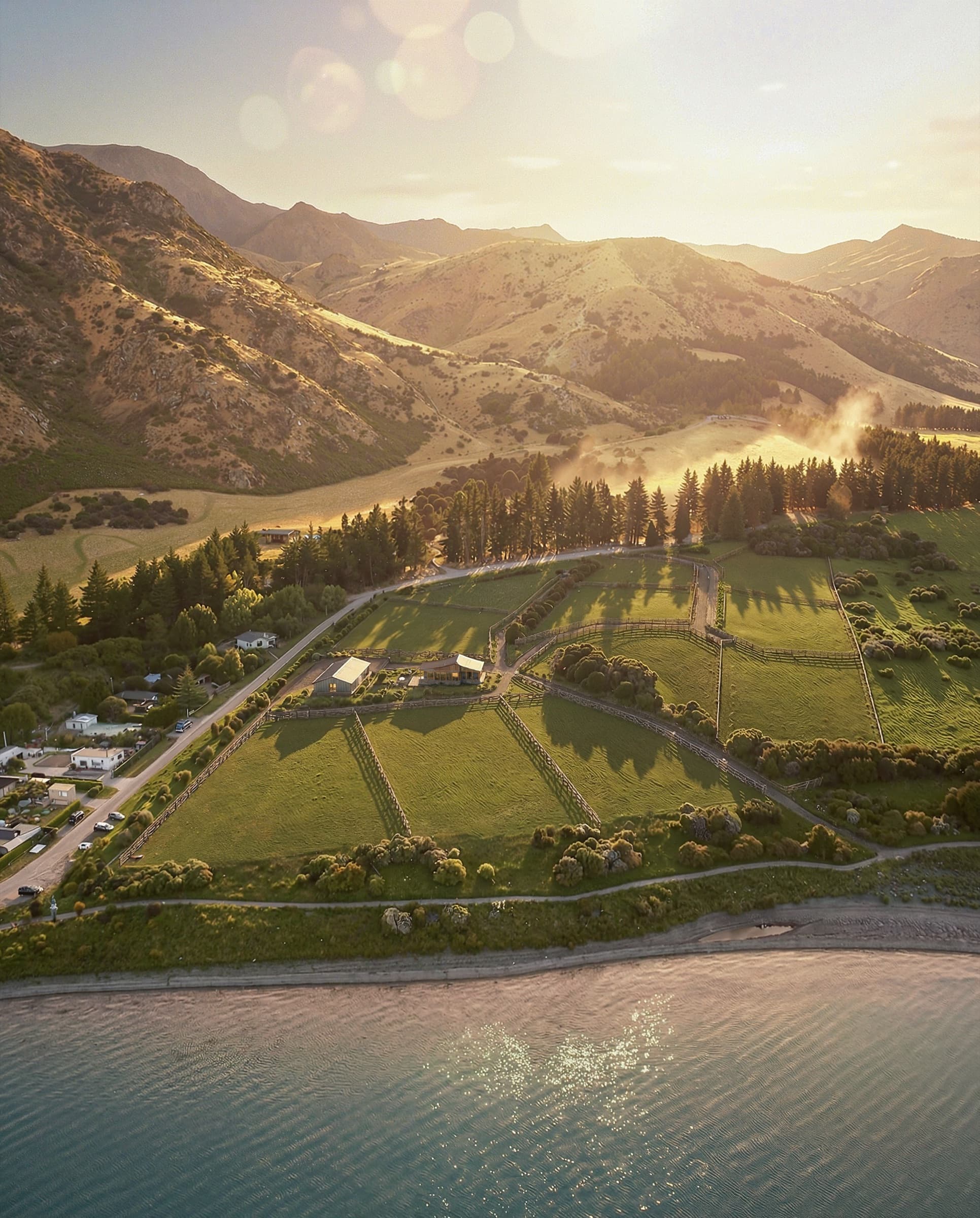
The Kōroto set includes aerial masterplan views, home exteriors and interiors, a long-form cinematic walkthrough and a project website.
View the Kōroto case studyUpper Clutha, Otago
Render Works creates architectural renders, film and development websites for the Upper Clutha area. Our confirmed local work is at Lake Hāwea: Kōroto combines aerial masterplan, home and interior renders with a film and website, while our selected-work portfolio documents a separate Timaru Creek high-country lodge visualisation. Both are at Lake Hāwea, not in Wānaka town.
Discuss a projectKōroto provides a published example of how a lakeside development can be presented from site scale down to the rooms. Timaru Creek, documented in our selected-work portfolio, adds a lodge example with exteriors, interiors and aerial context. The two briefs answer different questions about the same lake setting.
The Kōroto set includes aerial masterplan views, home exteriors and interiors, a long-form cinematic walkthrough and a project website.
View the Kōroto case studyA single lake-facing image cannot explain lot layout, arrival and the rooms. The Kōroto sequence moves from the full site to individual homes and then interiors, with the lake relationship checked at each scale.
| View | Question it answers | Source to check |
|---|---|---|
| Masterplan aerial | Where are the lots, shared elements, access and water? | Current site plan, survey and landscape plan |
| Home exterior | How does the particular building sit on its own lot? | Lot-specific plans, elevations and levels |
| Interior outlook | What does the actual window and room orientation frame? | Plans, sections, window schedule and checked camera position |
Name the actual site and settlement. Wānaka and Lake Hāwea sit in the wider Queenstown-Lakes District, but a Lake Hāwea project should not be presented as a Wānaka town project. The site-specific district-plan map and approved drawings should drive claims about built form and outlook.
Start with Queenstown Lakes District Council's district-plan maps. Those maps distinguish the Wānaka and Hāwea areas. The designer or planner should identify the applicable provisions for the exact property before visualisation starts.
Show lot layout, access and shared elements at site scale.
Check camera, window and landform before a view claim is published.
Choose room views with actual openings and selected finishes.
Plan stills, film and website layouts from one source record.
No. The confirmed Kōroto and Timaru Creek examples are at Lake Hāwea. We serve Wānaka as part of the Upper Clutha area and name the actual project location on every image.
Yes. Kōroto is a published example with aerial and home renders, a cinematic walkthrough and a bespoke website built around the same visual set.
Send the site survey, plans, sections, window positions, levels and dated site photography. The camera should be checked from the actual lot and room before the outlook is described in a campaign.
Last updated 16 November 2026

Send the exact site location, drawings and intended campaign uses. We can identify the cameras and source material needed for an accurate image set.