New Zealand developers
What should a Wānaka-area masterplan render show?
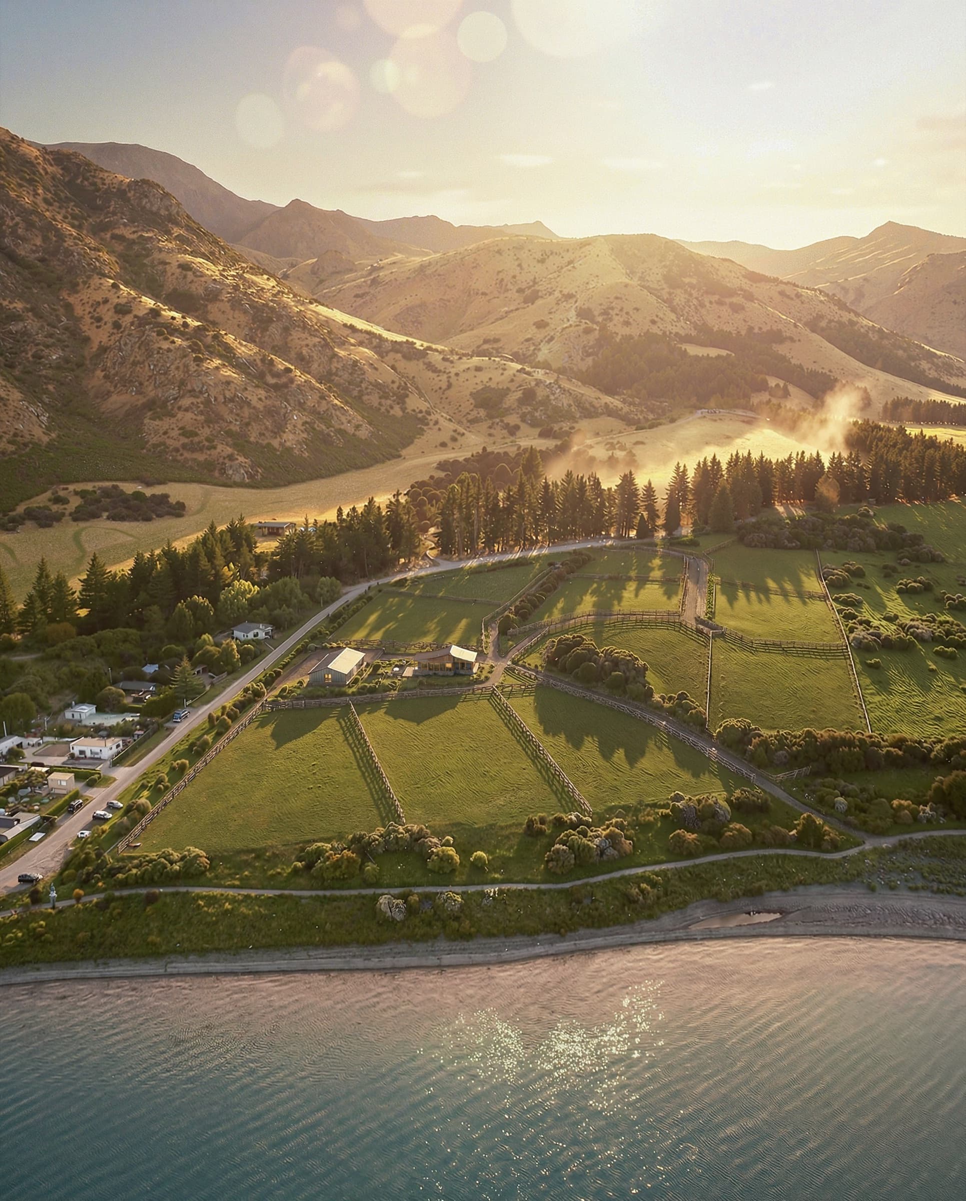
A masterplan aerial should let a reader trace the lots, access and shared spaces before admiring the landscape. At Kōroto, Lake Hāwea, the aerial set places homes, a boat house and a clubhouse within the lakeside site. The exact property should be named in the caption; Lake Hāwea is not Wānaka town.
Which records control the aerial?
The Queenstown Lakes District Council maps distinguish Lake Hāwea and Wānaka areas. The project team should identify the applicable map for its exact site. The image team needs the current project drawings rather than relying on a district map to infer lot geometry.
| Source | Aerial question it answers |
|---|---|
| Survey and subdivision plan | Where are lots, boundaries and levels? |
| Access and landscape drawings | How do people move through the site? |
| Building schedule | Which home type belongs on each lot? |
| Shared-facility drawings | What is actually proposed for the boat house or clubhouse? |
| Dated site photos | What existing landform and neighbours should remain? |
What order should the camera set follow?
Start with one readable whole-site aerial. Then use a closer view for the lots or shared facility that need more explanation. An image from each individual home follows only when a buyer needs to compare the homes. The Kōroto case study shows how aerial, exterior and interior assets formed one campaign. The outlook accuracy guide covers claims from a particular lot.
Frequently asked questions
Can a masterplan aerial show every detail?
It should show site structure first. Use closer images for architecture, materials and individual room outlooks.
Should we label Lake Hāwea as Wānaka?
No. Use the actual site name and settlement. A Wānaka-area service page can cover nearby work while each project caption remains precise.
What should we send for a quote?
Send the latest survey, subdivision plan, building schedule, landscape plan and intended placements through the project enquiry.

Plan your Wānaka-area image set
Send the current drawings, site material and intended image uses so we can scope the views.
Discuss your project